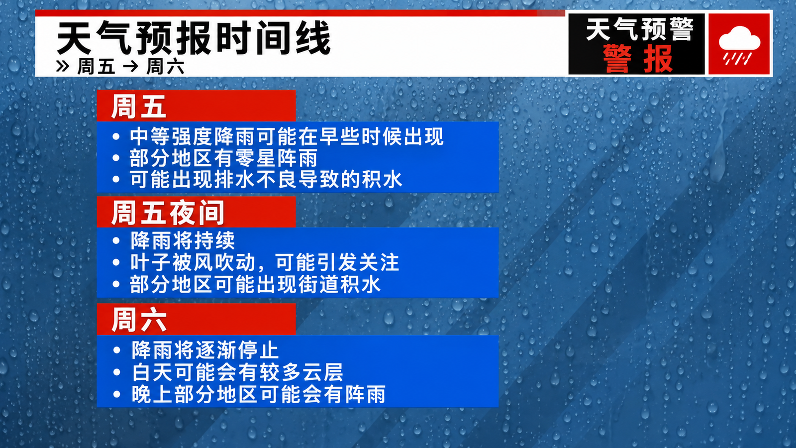
A powerful storm will sweep through Massachusetts on Friday, bringing the worst flood risk to the southeastern part of the state; then the weather will turn colder over the weekend.
Southeastern Massachusetts is expected to receive its heaviest rainfall yet, with drops potentially reaching 1 to 3 inches (about 25 to 76 millimeters) by Friday night. Some areas could even see 4 to 5 inches (about 102 to 127 millimeters), increasing the risk of flooding in streets, underpasses, and other low-lying areas.
Flood-prone communities such as New Bedford and Fall River may face greater risks. Additionally, fallen leaves clogging storm drains can cause waterlogging in areas that wouldn’t normally be prone to flooding.
The National Weather Service has issued a flood warning for southeastern Massachusetts and its coastal areas, including the South Shore, the South Coast, and Cape Cod and surrounding islands, which will remain in effect until Saturday morning.
Rain is also expected in other parts of Massachusetts, but the amount is expected to be relatively light. Thunderstorms are also possible in some areas, especially along the coast and south. Heavy rain may reduce visibility and cause travel disruptions.
Despite the rainfall, temperatures will remain at unusually high levels for early November.
Temperatures are expected to reach 69 degrees Fahrenheit (about 20.6 degrees Celsius) in Boston and Springfield on Friday, while Worcester is projected to reach 68 degrees Fahrenheit (about 20 degrees Celsius). Pittsfield and Hyannis may also see temperatures around 65 degrees Fahrenheit (about 18.3 degrees Celsius).
Local forecast for Friday:
Boston : High 69°C, low 64°C, showers possible with thunderstorms, localized fog.
Hynes : High 65°C, low 61°C, rain and thunderstorms, localized fog.
Pittsfield : High 65°C, low 57°C, showers possible, localized fog.
Springfield : High 69°C, low 64°C, rain possible with thunderstorms and heavy rain, localized fog.
Worcester : High 68°C, low 64°C, showers possible with thunderstorms, localized fog.
Overnight temperatures will also remain unusually mild. Boston is expected to see a low of only around 64 degrees Fahrenheit (about 18 degrees Celsius), close to the previous record high of 65 degrees Fahrenheit (about 18.3 degrees Celsius) for that date. Worcester and Springfield are also likely to see nighttime temperatures around 64 degrees Fahrenheit.
The rain is expected to subside earlier on Saturday; however, a new round of rain is anticipated later Saturday evening as cold air moves into the region. Heavy rain is possible in some areas, and even small hailstones are possible in isolated locations.
The weather will gradually improve on Sunday, and Massachusetts will begin to return to November normalcy.
On Sunday and next week, high temperatures are expected to drop to the 50°F (around 10 to 15°C) range, while overnight lows will fall to the 30 to 40°F (around -1 to 9°C) range. Next week will also be much drier, with a lower chance of rain.